Late Pleistocene World Map Exercise
Objective: The purpose of this assignment is to understanding the world at the time of the of the last great 'ice age.' Your map should look similar to the one to the left; however, it will include the following additional items: human migration routes, labels, and a key.
Open and print the PDF map below. Combine all of the sheets to create a large map.
Required Elements
|
Pleistocene Shoreline-- draw
Use the following resource: World History Atlas: Mapping the Human Journey (Fully Revised and Updated). Dorling Kindersly Publishers. (2005). On the map, show the shoreline during the Late Pleistocene.
Coloring Color the map as a physical map. Show the vegetation patterns during the Late Pleistocene Period. Coastal Resources-- shade and label Include the Indo-Pacific biogeographic region on the map. As humans first expanded their range, they stayed near the coast for warmth and a stable food source. Human Range Expansion-- draw the routes Use different colors to show when and where humans migrated out of Africa. |
Ice Sheets-- draw and label
Land Bridges-- label
Glacial Lakes-- draw and label
|
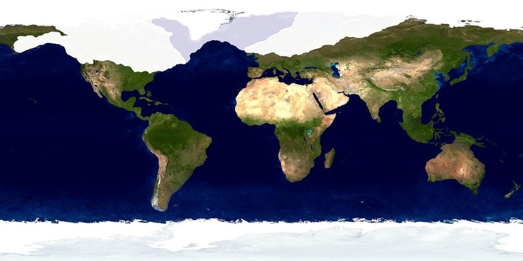
Late Pleistocene Coastlines
Historical Map: Last Ice Age (Planetary Visions)
Source: Pleistocene Project
Source: Althistory Wiki
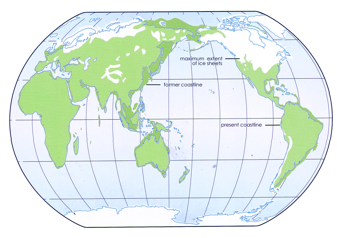
Ice Sheets
The Late Pleistocene Ice Sheets. [Image Source: Pleistocene Biogeography.]
|
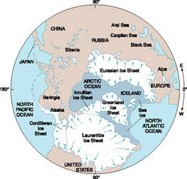
Polar view of the Late Pleistocene Ice Sheets. [Image Source: Earth Through Time.]
|
|
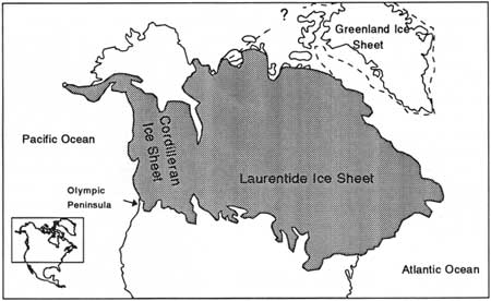
The Cordilleran and Laurentide Ice Sheets of North America. Image Source: National Park Service.
Visit this link to learn more about the evidence of Glaciers and Ice Ages |
|
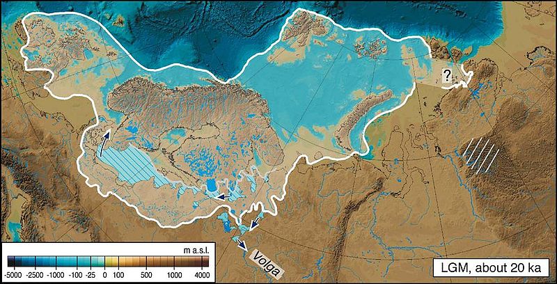
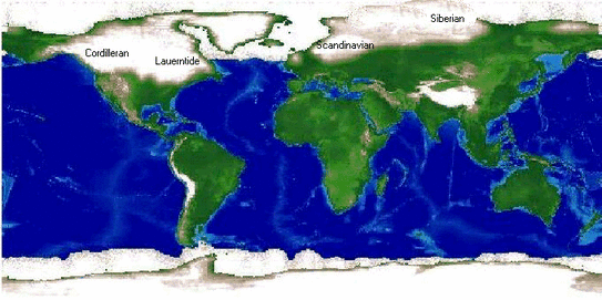
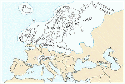
These maps show the extent of the Scandinavian and Siberian Ice Sheets during the Late Pleistocene. [Image Sources: Wikipedia (left) and Prehistoric Britain Blog (right)
|
|
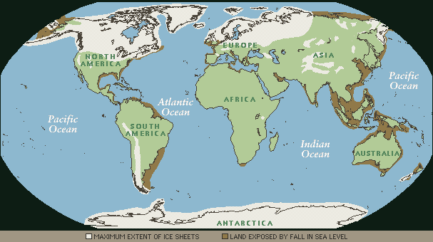
Land Bridges
Beringia
During the last major glacial episode, the world's ocean levels were 130-meters than today because so much water was used in the creation of the ice sheets. This exposed large areas of land. In several areas, these acted as land bridges that made it possible for humans and other animals to expand around the globe.
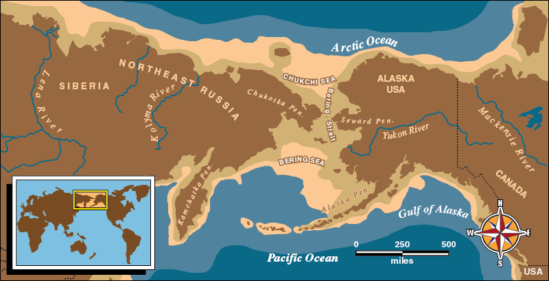
Beringia (above). During the Late Pleistocene, this land bridge was a polar desert which prevented it from being covered by ice sheets. It served as a connection between Siberia and Alaska. This may have played a critical role in the arrival of human populations in the Americas. [Image Source: National Park Service]
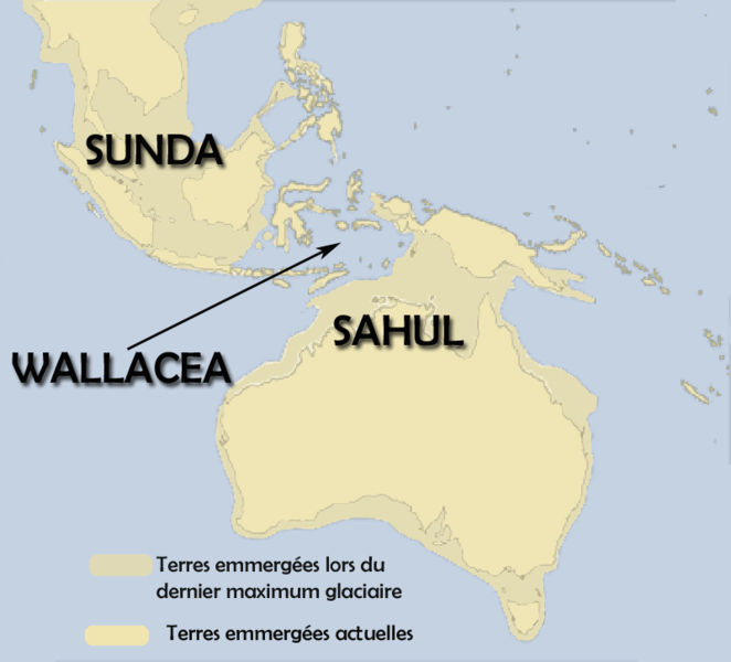
Sunda and Sahul
|
Sunda and Sahul (left). The region of Wallacea acts as biogeographical barrier preventing the exchange of most plants and animals between Eurasia and Australasia. However, humans were able to use sailing technology to cross this gap. Evidence suggests that humans arrived in Australia around 50,000 years ago.
[Image Source: Wikipedia.] |
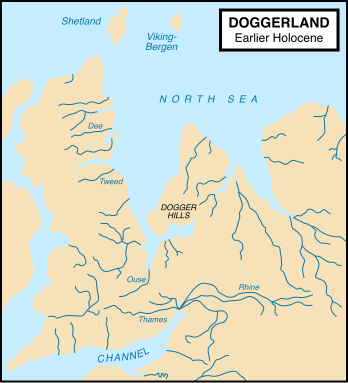
Doggerland
|
Doggerland (right). This region was covered by ice sheets until the very end of the Ice Age. As the glaciers began to melt, it provided a limited window for humans and other animals to arrive in Britain.
Image Source: Wikipedia] |
|
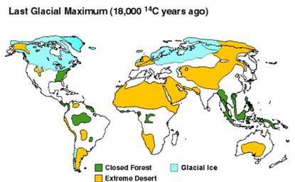
Pleistocene Vegetation
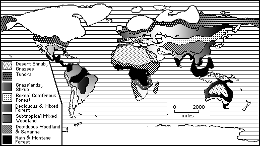
Above: Late Pleistocene Vegetation Patterns
|
|
|
|
Indo-Pacific Biogeographic Region
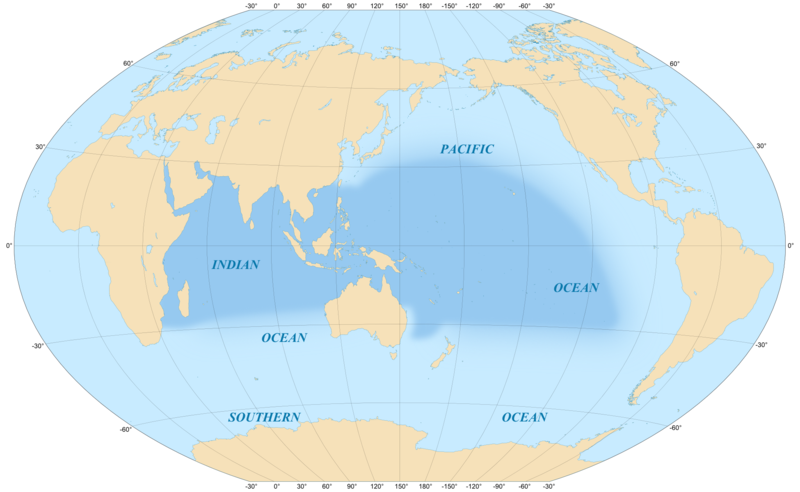
The earliest human range expansion was along the southern shores of Eurasia. Humans stayed close to the coast for milder climates and a stable food source. [Image Source: Wikipedia]
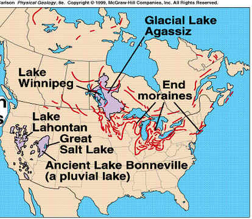
Glacial Lakes
|
Generally, most of the planet was colder and drier than today. The one notable exception was the western part of middle North America. This region contained large lakes. The Great Salt Lake is the largest remnant from this period. Also, as the ice sheets began to melt, huge glacial lakes began to form.
Image Source (right): Ice Ages of the Pleistocene] 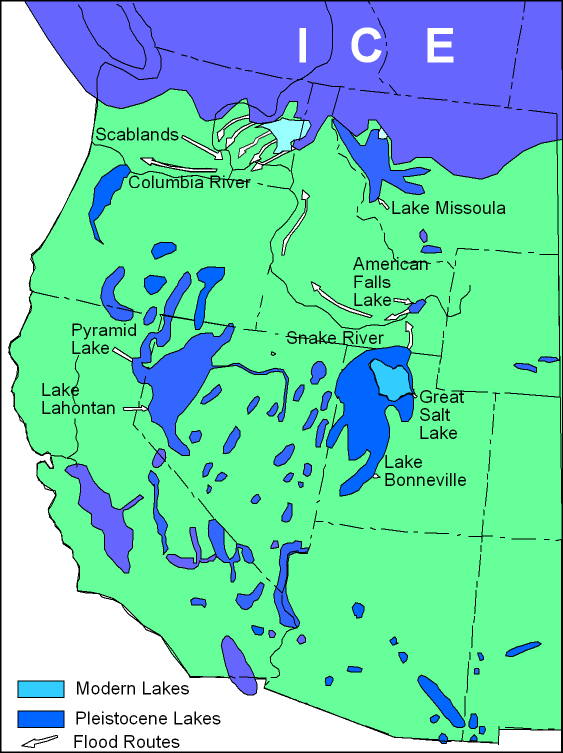
|
[Image Source (left): Idaho Digital Geology]
|
|
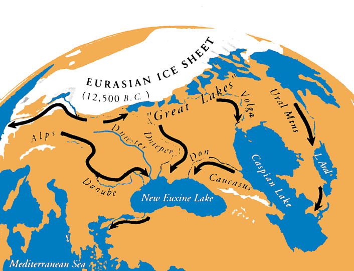
As the Eurasian Ice Sheets began to melt, they refilled Lake Aral (aka the Aral Sea), Caspian Lake (aka The Caspian Sea), and Lake Euxine (aka the Black Sea).
[Image Source: Geoscience and Environment] |
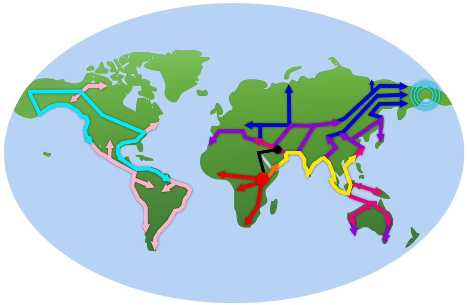
Human Range Expansion (Migration)
|
The map above shows the range expansion of humans out of Africa and around the world.
[Image Source: Pleistocene Project] |
